Friday, May 15, 2015

Flattop Mountain and Hallet Peak

I've never been as cold as I was 12,713 feet above sea level atop Hallet Peak. It was mid-April and I'd just come from the summit of Flattop Mountain, slightly lower at 12,324 feet high. The icy wind ripped through my jacket entombing my fingers. No matter how deep I buried them in my coat pockets they barely felt at all. I only stayed on the summit for a few minutes before heading back to lower and warmer elevations.

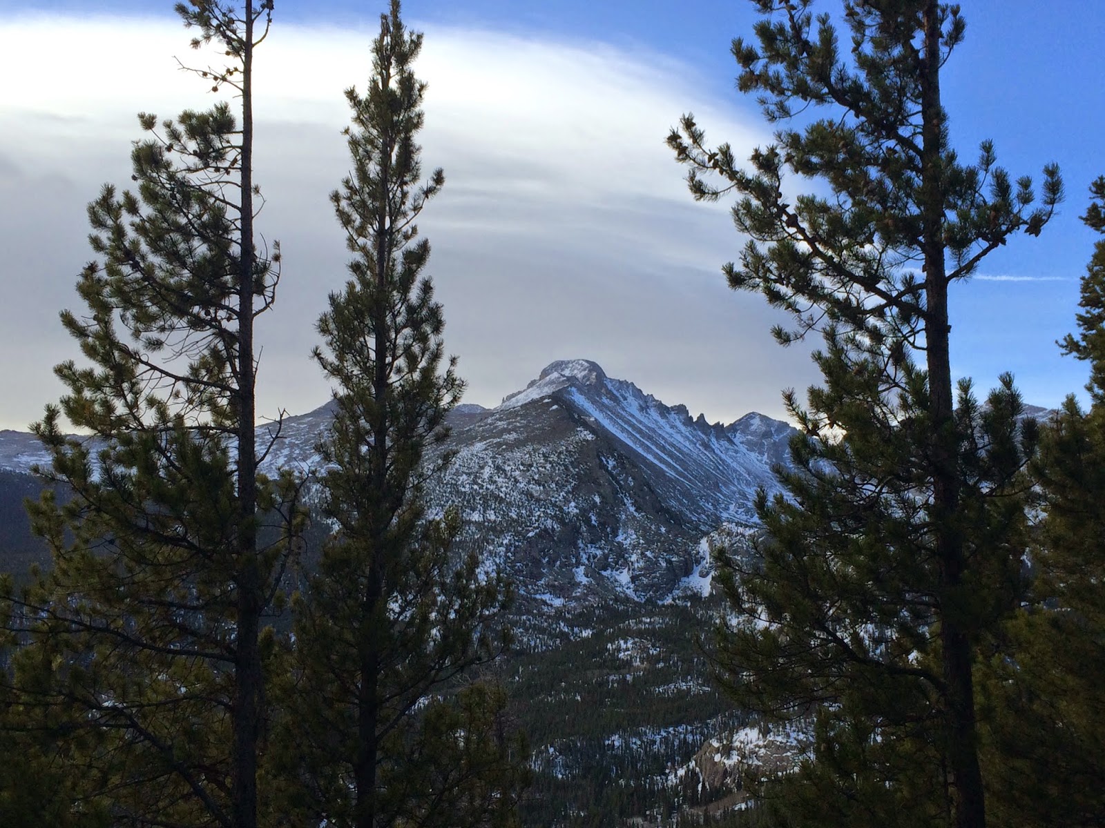
An ancient sea bed uplifted by forces deep within the earth then gashed by glacial teeth, these peaks in Rocky Mountain National Park have been torn asunder by their own loftiness. The peaks catch the clouds that release the snow that builds up and scrapes out pockets and then lakes over millennia by its freezing and unfreezing and flowing and refreezing.

Eventually, the ice becomes so thick and cold and deep that it stays a frozen river of massive chunks of ice--a glacier--crawling down a mountainside and taking everything in its path with it. Then a few thousand years later the earth warms up and almost all of the glacier melts and people hike out to it and try but fail to comprehend the vastness and consequence of time.


Friday, May 8, 2015

Warner Point

Warner Point is the highest place on the south rim of the Black Canyon of the Gunnison. I stopped there and hiked a couple miles down into the canyon (but not all the way to the Gunnison River) on Sunday on my way back to Denver.


Thursday, May 7, 2015

Ouray

After Canyonlands, I drove through the grand western Colorado countryside until I reached Ouray, where I spent the night. Nestled delicately inside a plunging valley, Ouray is one of the most beautiful little towns there is.

I soaked for an hour in hot springs just up the road, then found a relatively cheap hotel on Ouray's Main Street. Late March is not Ouray's busy season so the town was mostly lifeless.

As the sun began to set, I had a quick dinner and wandered down Main Street to an overlook high above the old mining town. Ouray unfolded below like a storybook.


Saturday, May 2, 2015

Druid Arch

I left Grand Junction a couple hours before dawn and passed through Moab, Utah as the sun was rising. About an hour later I arrived at the Elephant Hill trailhead in the Needles Section of Canyonlands National Park and set off on my hike for Druid Arch.

Druid Arch, named for the builders of Stonehenge, stands over 100 feet tall at the south end of Elephant Canyon. Most of the 5.8 mile hike out to the lonely angular arch is through a sandy stream bed. The last quarter mile or so though climbs up a giant rock amphitheater to humbling views directly beneath Druid Arch. Equally impressive are the views down Elephant Canyon's bulbous walls and pinnacles.