Wednesday, September 30, 2015

Trail Ridge Road

Trail Ridge Road is the highest continuously paved road in the United States and the primary arterial through Rocky Mountain National Park. Being continuously paved is an important distinction because the road up Mount Evans is actually the highest but it dead-ends. I wanted to drive Trail Ridge before snow made that impossible and the park closed the road for the season in a month or so.

The weekend after climbing South Arapahoe Peak, I only hiked a few miles along the Ute Trail, which juts off from Trail Ridge Road, before stopped at a few pull-offs along the road to take in the awesome views. That morning, the Ute Trail abounded with elk and impressive perspectives of the northwest face of Longs Peak as the sun brightened the landscape and turned the sky colors.


Tuesday, September 29, 2015

South Arapahoe Peak

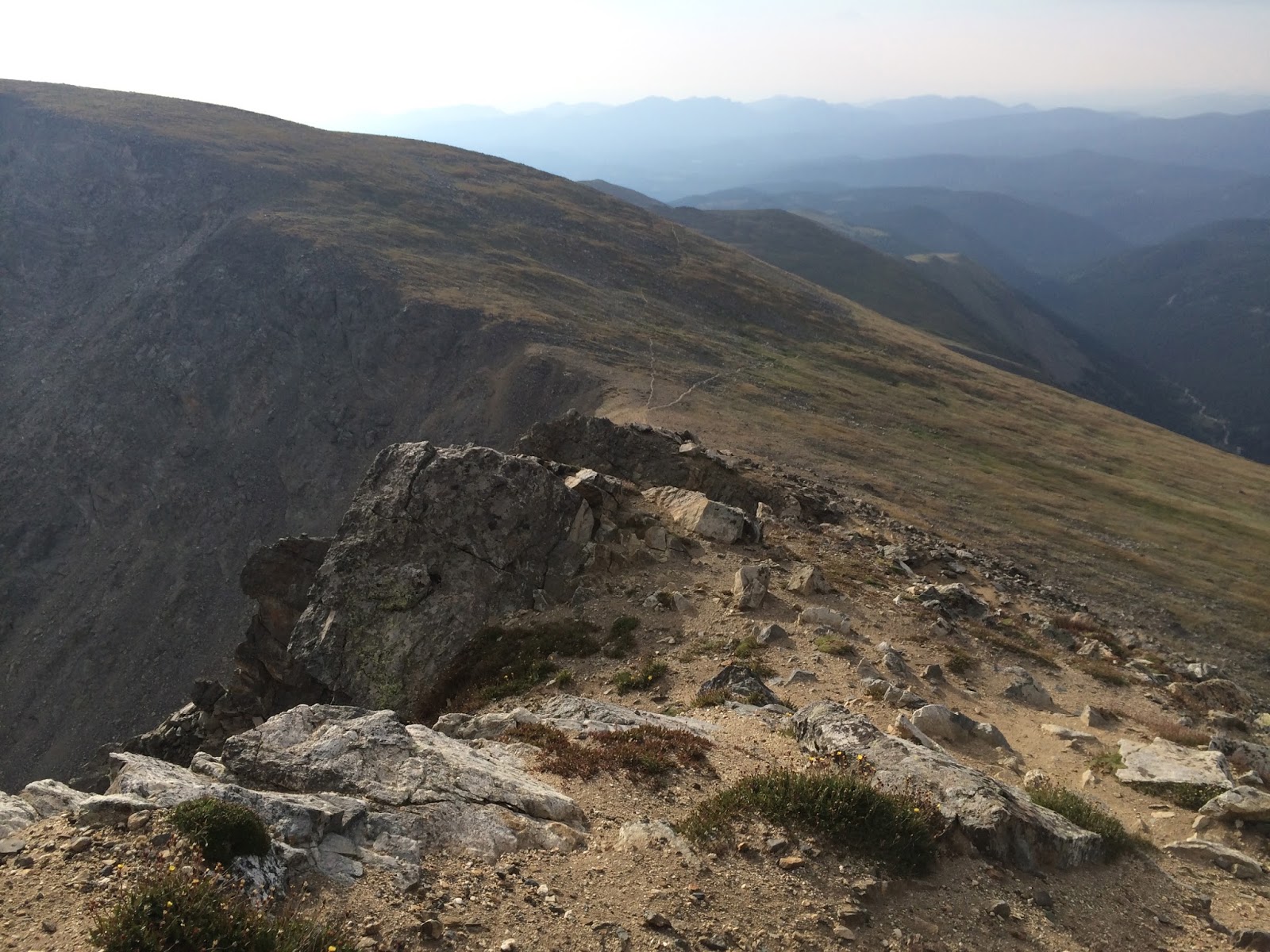
I took a break from the mountains for a couple weeks after climbing Longs, but on August 22 ventured again towards the glaciated peaks of the Continental Divide. This time to the stretch designated as Indian Peaks Wilderness, just south of Rocky Mountain National Park.

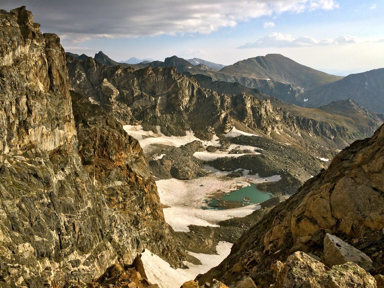
From the Fourth of July Trailhead, about five miles up a bumpy dirt road outside Nederland, the hike steadily gains altitude, passes the abandoned Fourth of July Mine, then reaches a dramatic drop-off, overlooking the giant Arapahoe Glacier and the magnificent, terraced lakes it feeds.

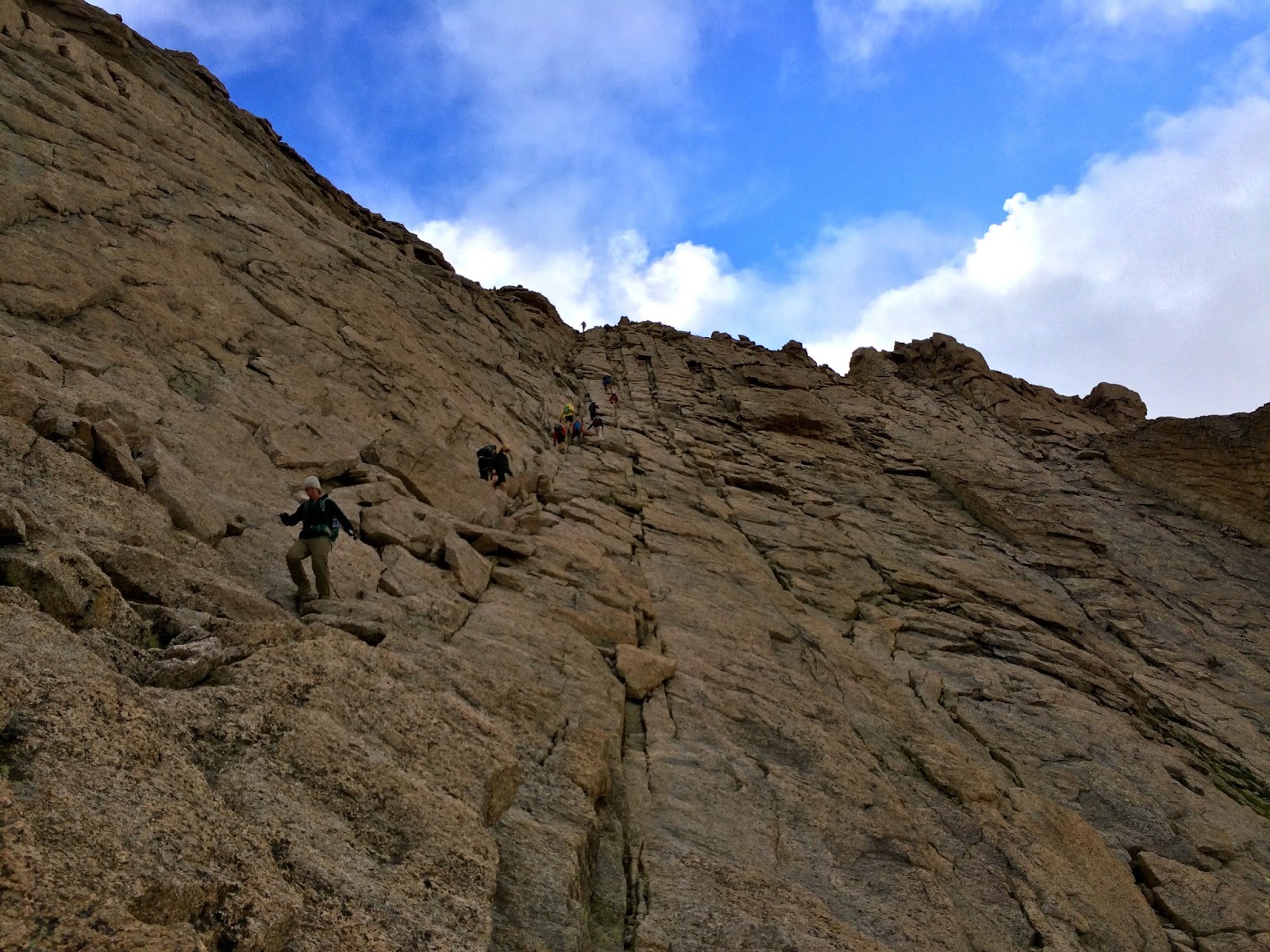
South Arapahoe Peak's summit is just a few hundred feet further up at 13,397 feet above sea level. After dragging myself to top, I ducked down inside a circular, roofless wall of stone and enjoyed coffee kept hot by my thermostat. It was different than how I have my coffee most days.


Saturday, September 19, 2015

Longs Peak

I see the distinctive flat pyramidal summit of Longs Peak nearly everyday from Denver. It is the northernmost 14er visible along the Front Range and one of the most popular to climb. The mountain has haunted me ever since I hiked to Chasm Lake at the base of Longs' summit spire last year and learned of the rugged, enticingly-named route to the top.

My hike began on August 9 in the 2 a.m. darkness. You have to start early to reach the summit before summertime thunderstorms hit the high elevations. A headlamp lit my way through Goblin Forest, the star-studded sky still pitch black overhead. The first two and a half hours of trudging uphill were in the dark. Ahead headlamps farther up the mountain allowed me to connect the dots of the route. Then a tinge of rose gold glimmered on the horizon and a shooting star whizzed through the fading night.

Sunrise hit approaching the Boulder Field. There's a small stone hut built near the base of the cantilevered Keyhole rockform where I momentarily ducked out of the wind. Once through the Keyhole it is only a mile and a half to the summit, but the way is intensely vertical. To get there tiptoe across the Ledges, clamber up the steep Trough and through the exposed Narrows (following the spray-painted yellow and red targets), then scramble to the summit on the smooth tilted granite Homestretch.

Standing on the summit is to see the world as only an eagle does. Ripping winds whipped up and then dispersed frenzied clouds. A few thousand feet below the sapphire waters of Chasm Lake glittered in the sunlight. The plains were flat and brown through the haze and the tiny, shadowy hulks of downtown Denver's skyscrapers barely stood out against the fields and farms, roads and reservoirs. Finally, I was able to look and see what it looked like looking back from Longs' barely reachable summit to which I had so often looked from Denver.